The Fort Ord Regional Trail and Greenway (FORTAG) is proposed as
a 30-mile regional network of paved recreational trails and greenways connecting communities to open space.
FORTAG will facilitate active transportation - expanding our region's opportunities for traveling between home, work, and commercial areas
by foot, bike, or wheelchair.
FORTAG is part of the larger effort to address climate change by reducing vehicle miles travelled under the Monterey County Regional Transportation Plan (RTP) and the California Climate Action Plan for Transportation
Infrastructure (CAPTI) .
Latest news: (See also TAMC FORTAG page) (See here for detailed timeline of over 420 FORTAG meetings, tours, approvals etc.) April 2025: FORTAG Segments 2 & 3 in detailed design phase in Marina along California Avenue, at Marina Equestrian Center, and near Intergarrison Rd May 2024: Groundbreaking ceremony for FORTAG Segment 1 in Del Rey Oaks and Seaside. Dec, 2022: FORTAG Segment 3 fully funded - from Marina Equestian Center to Jerry Smith Trailhead - funded by Federal Highways Administration and TAMC Measure X. November 2016: $20M in funding for FORTAG approved by Monterey County voters as part of the county-wide Transportation Investment and Safety Plan, enabled by Measure X. |
Unofficial master map - 28 May 2021 (for latest official map, see here)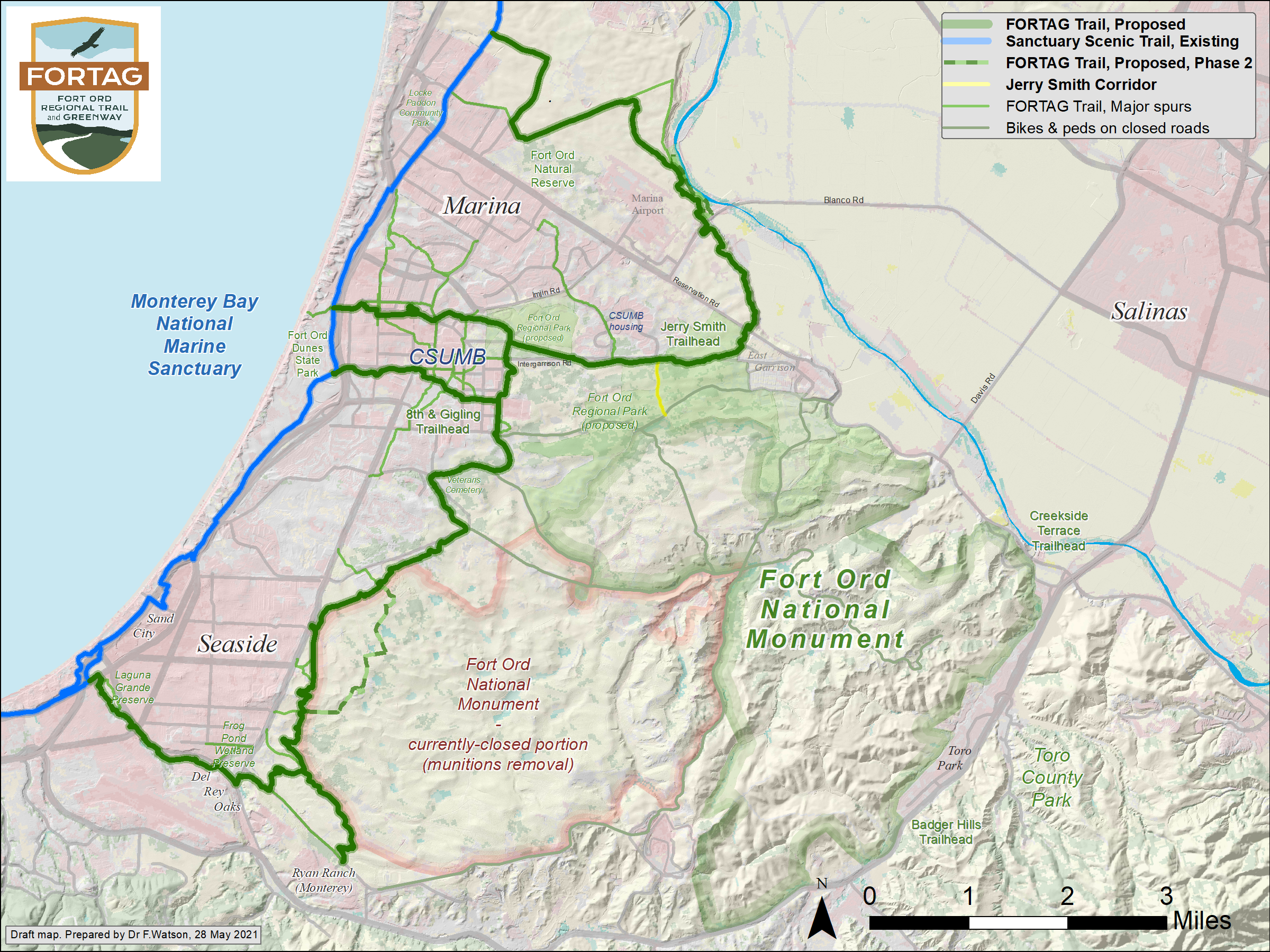