Maps of particular relevance to
the Seaside general plan update
(most of these are about 5 MB or more, so please be patient, or right-click and save to your desktop)
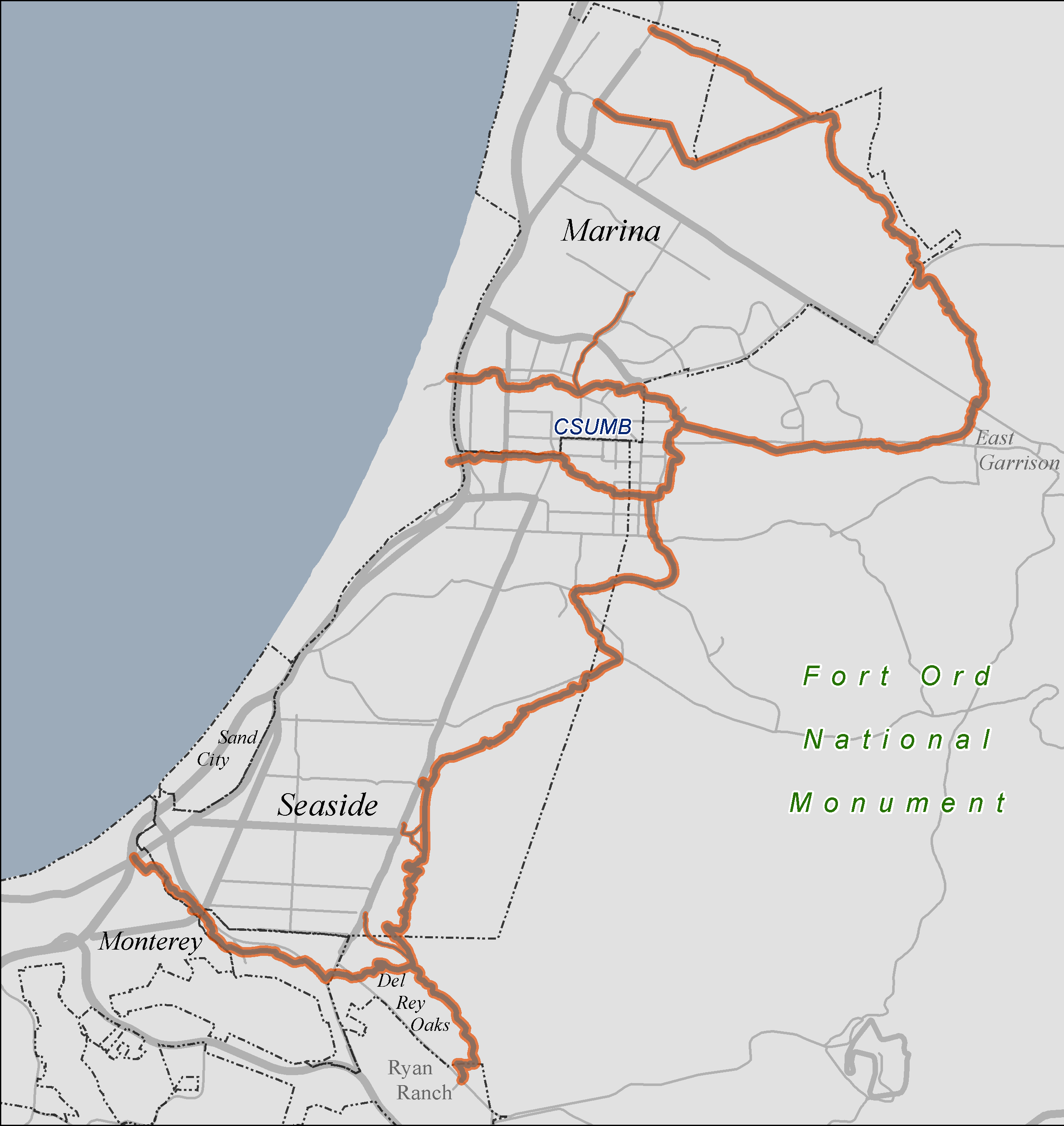
Former Fort Ord - Simple layout - 2 Sep 2016
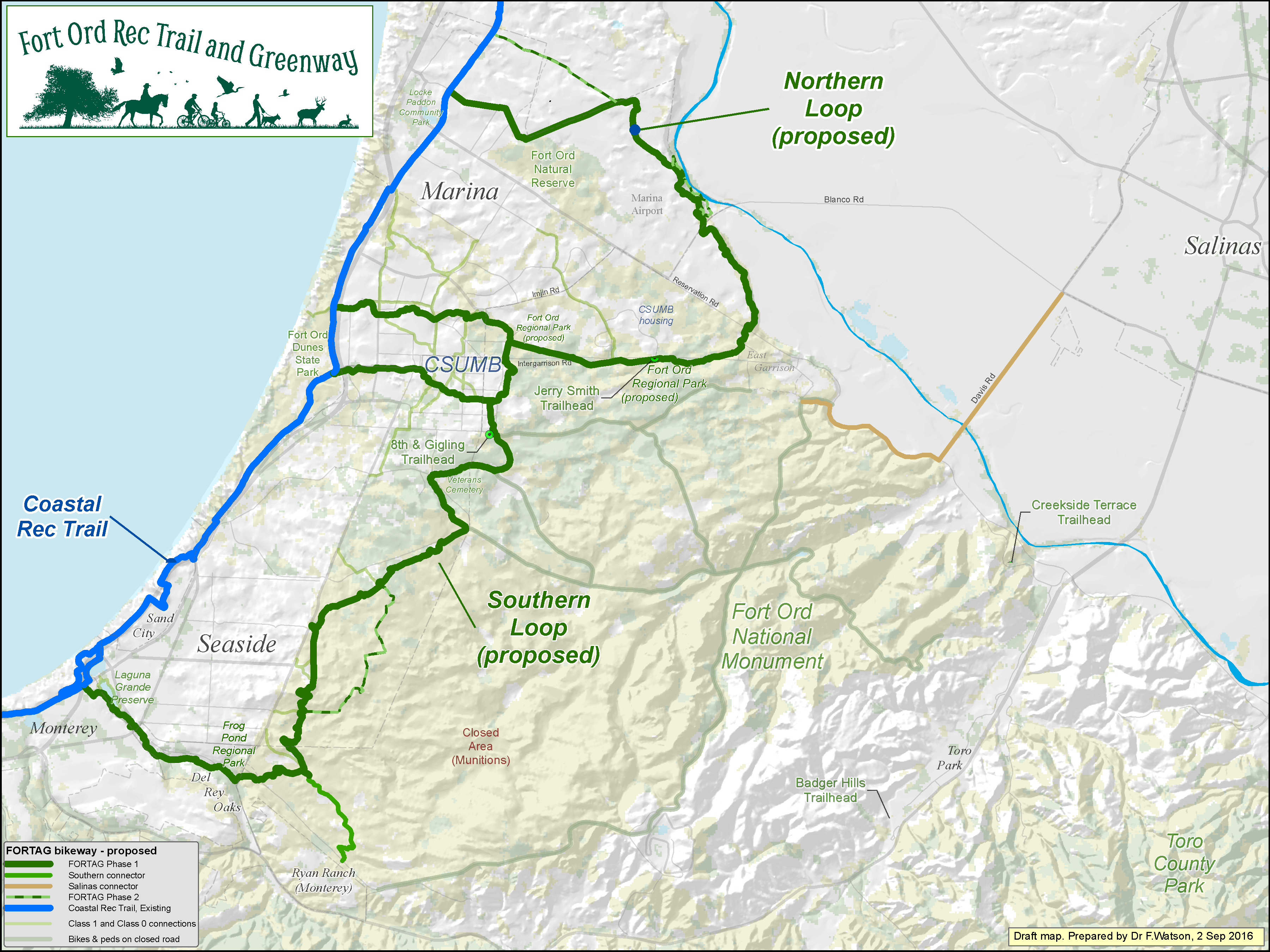
Click map to enlarge
Seaside - vertical layout - 27 Oct 2016
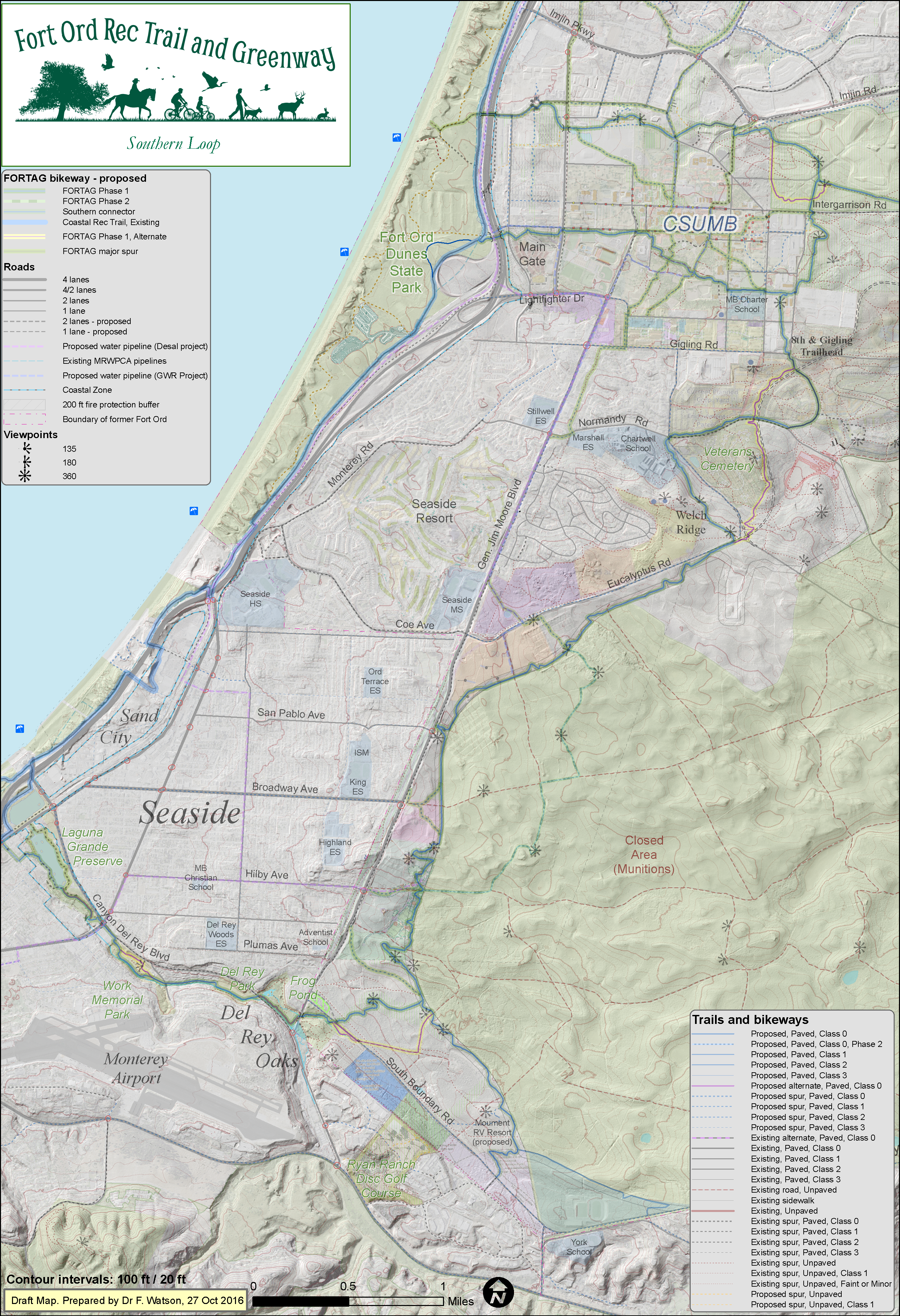
Click map to enlarge
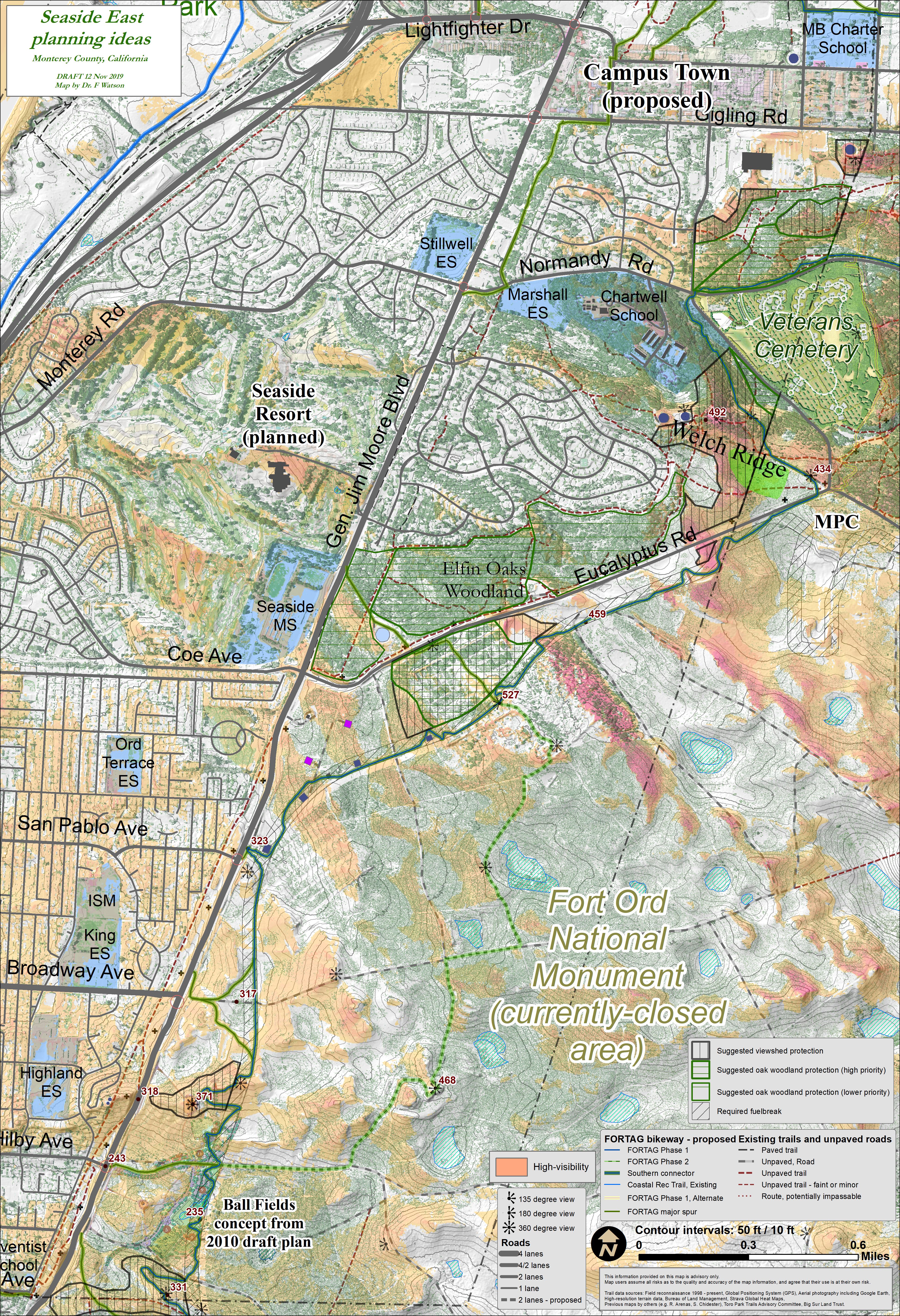
Seaside East - 6 Dec 2016
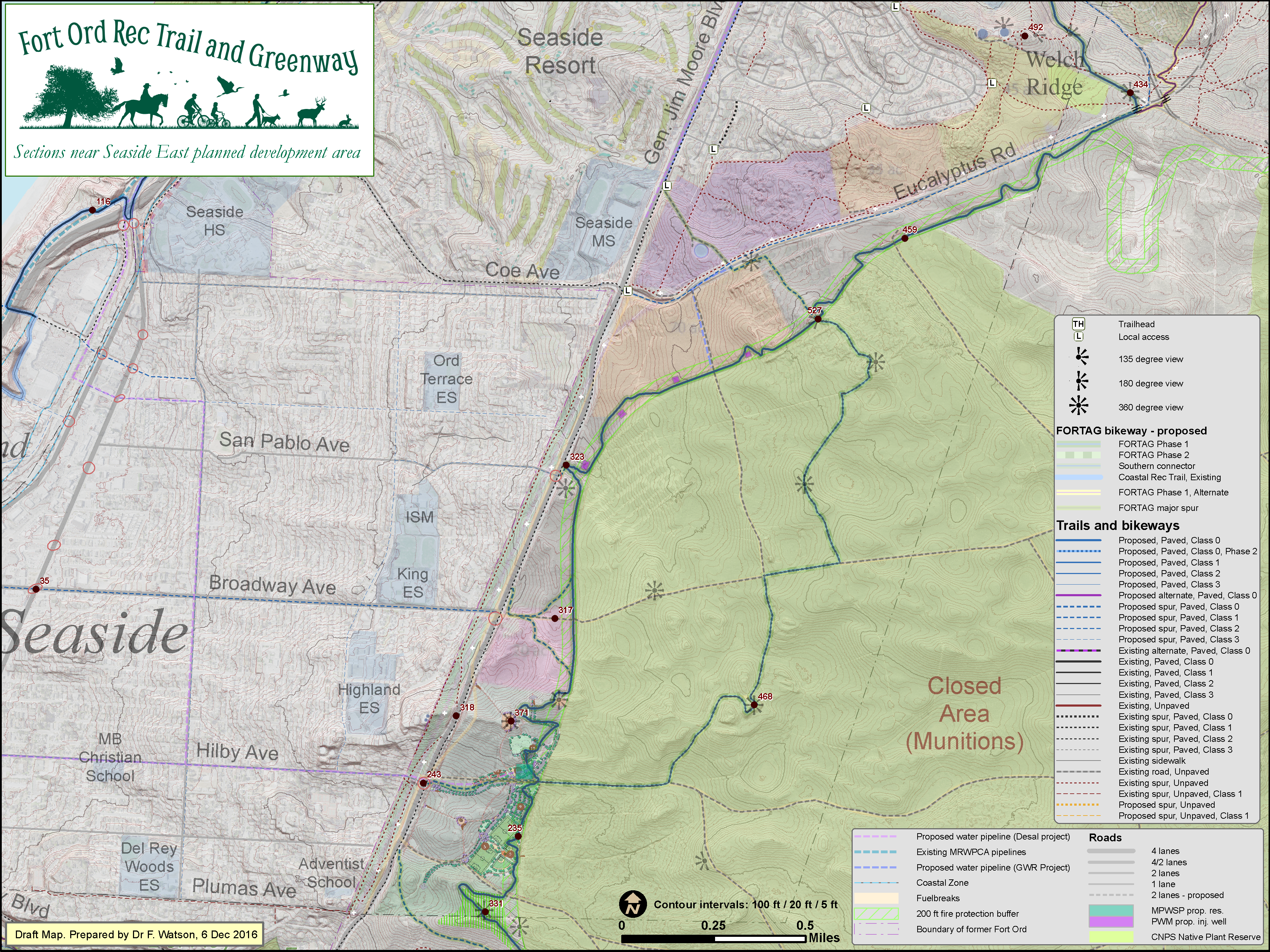
Click map to enlarge
Seaside East - terrain elevation - 6 Dec 2016
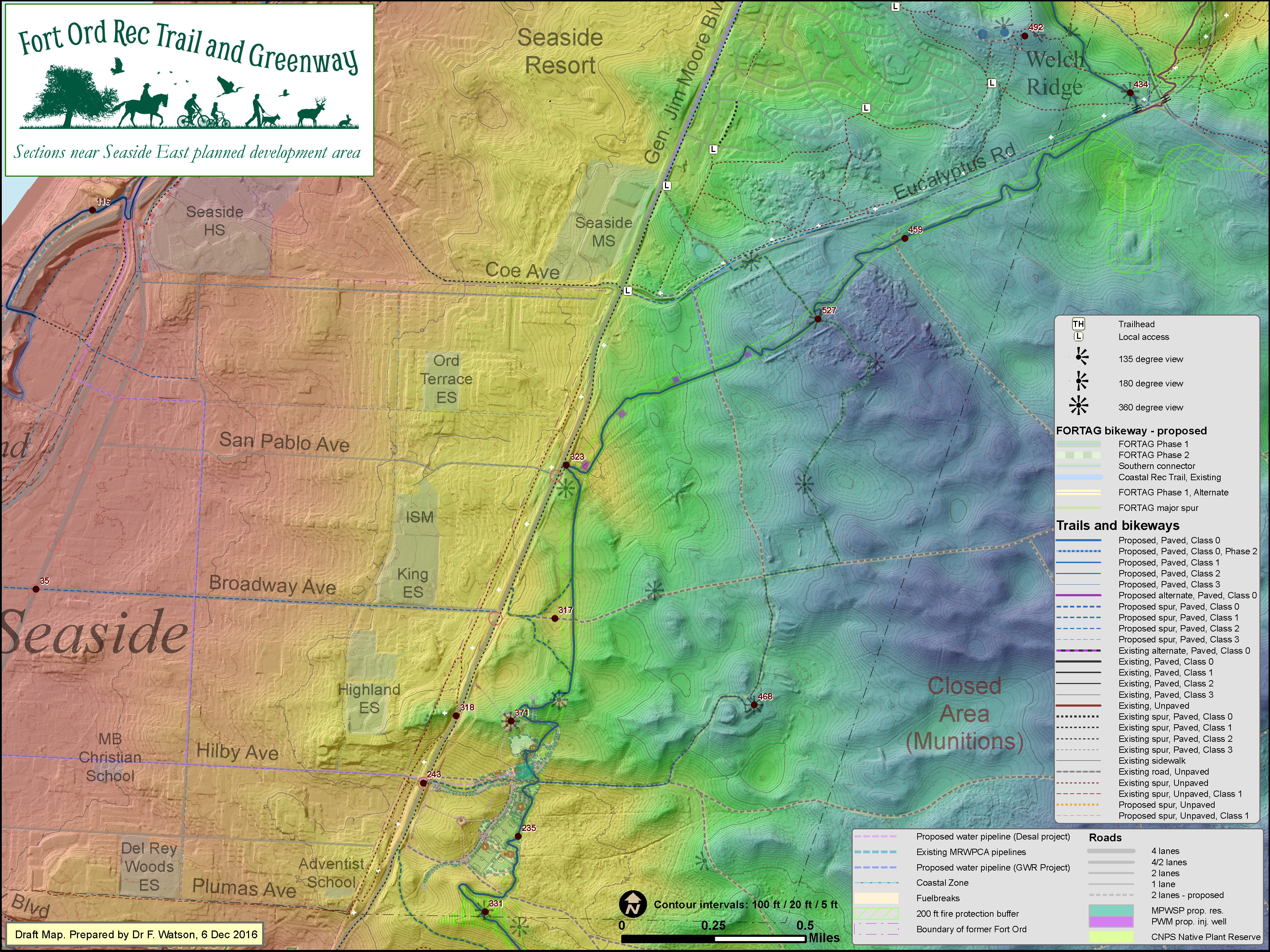
Click map to enlarge
Seaside East - playing fields concept - 27 Oct 2016
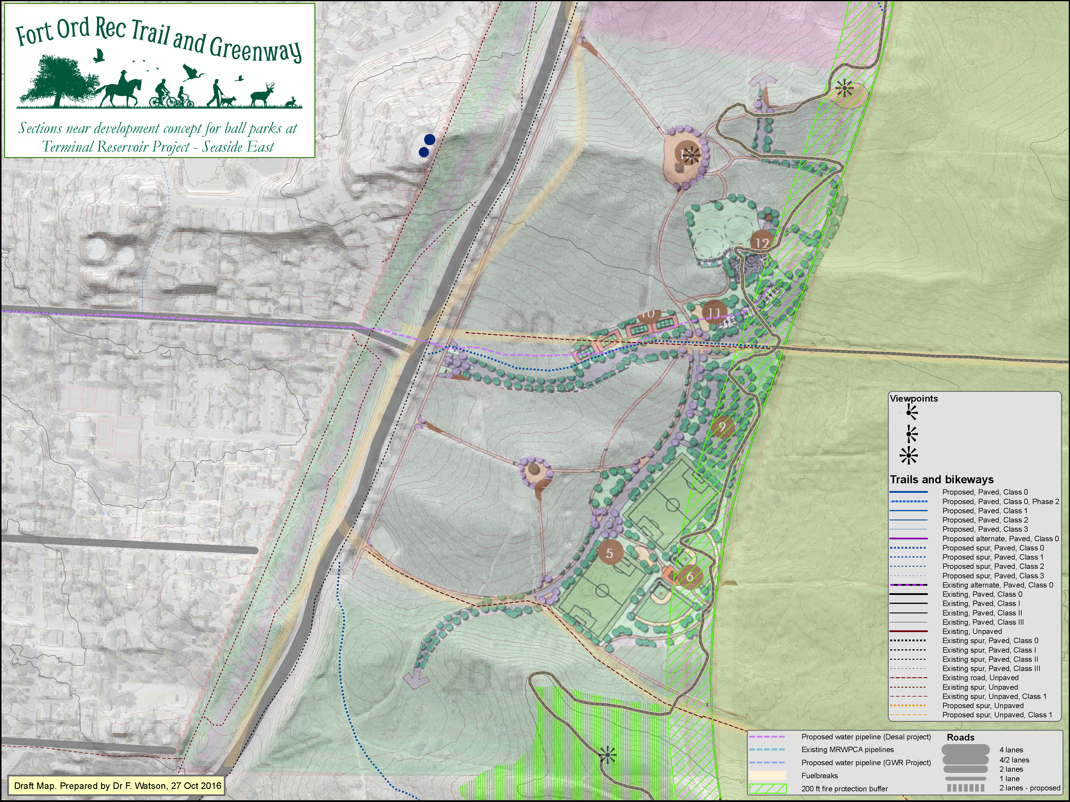
Click map to enlarge
Seaside East - injection wells - 27 Oct 2016
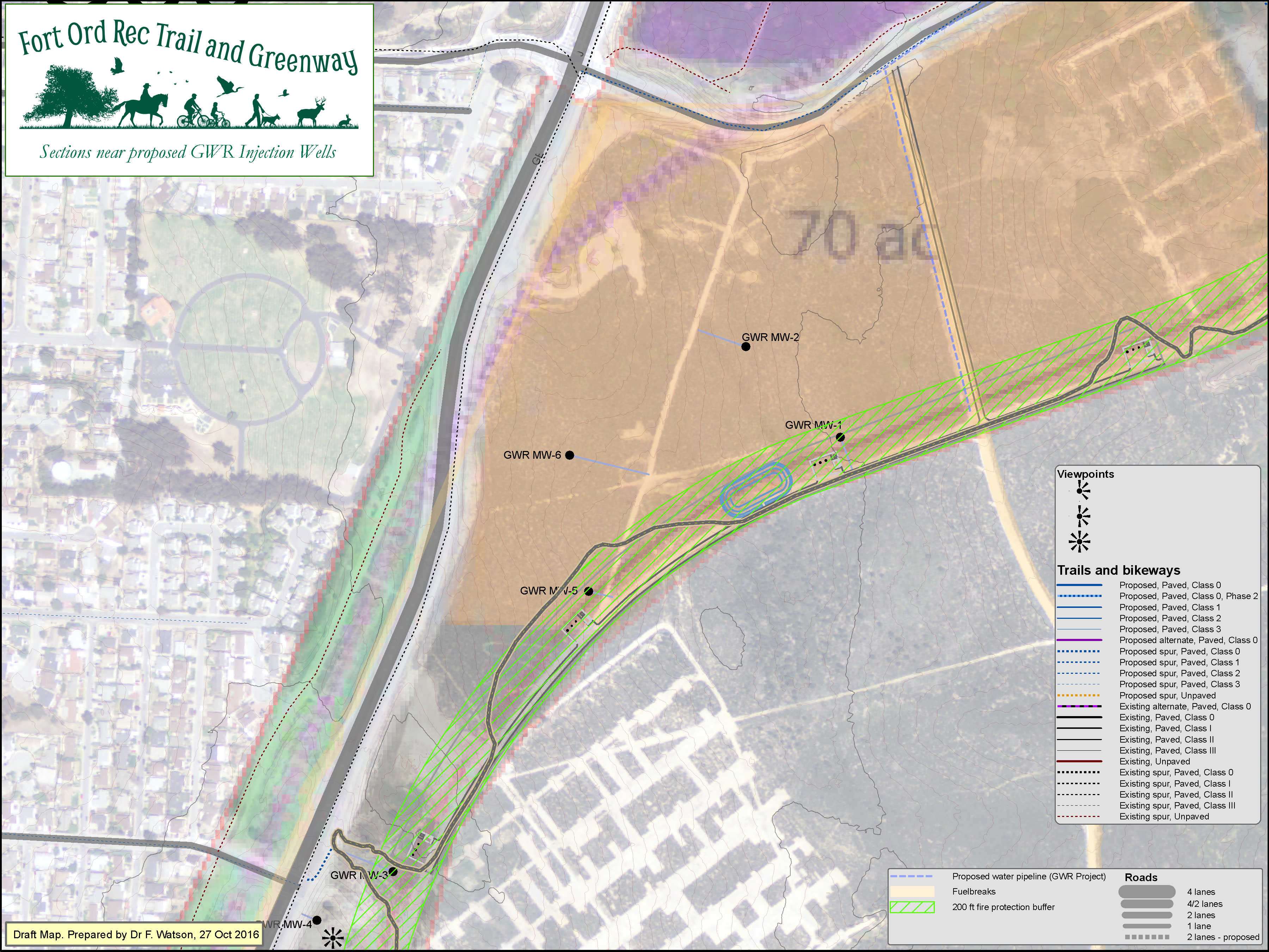
Click map to enlarge
CSUMB - 23 Sep 2016
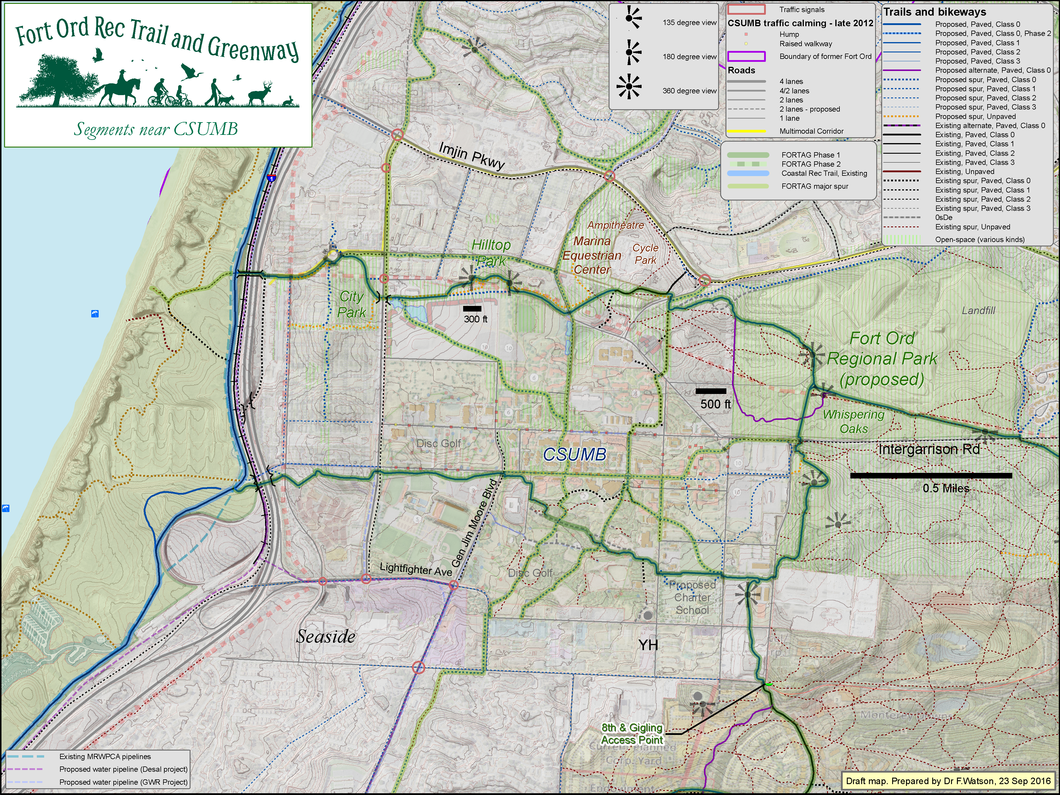
Click map to enlarge
CSUMB southeast - 29 April 2015
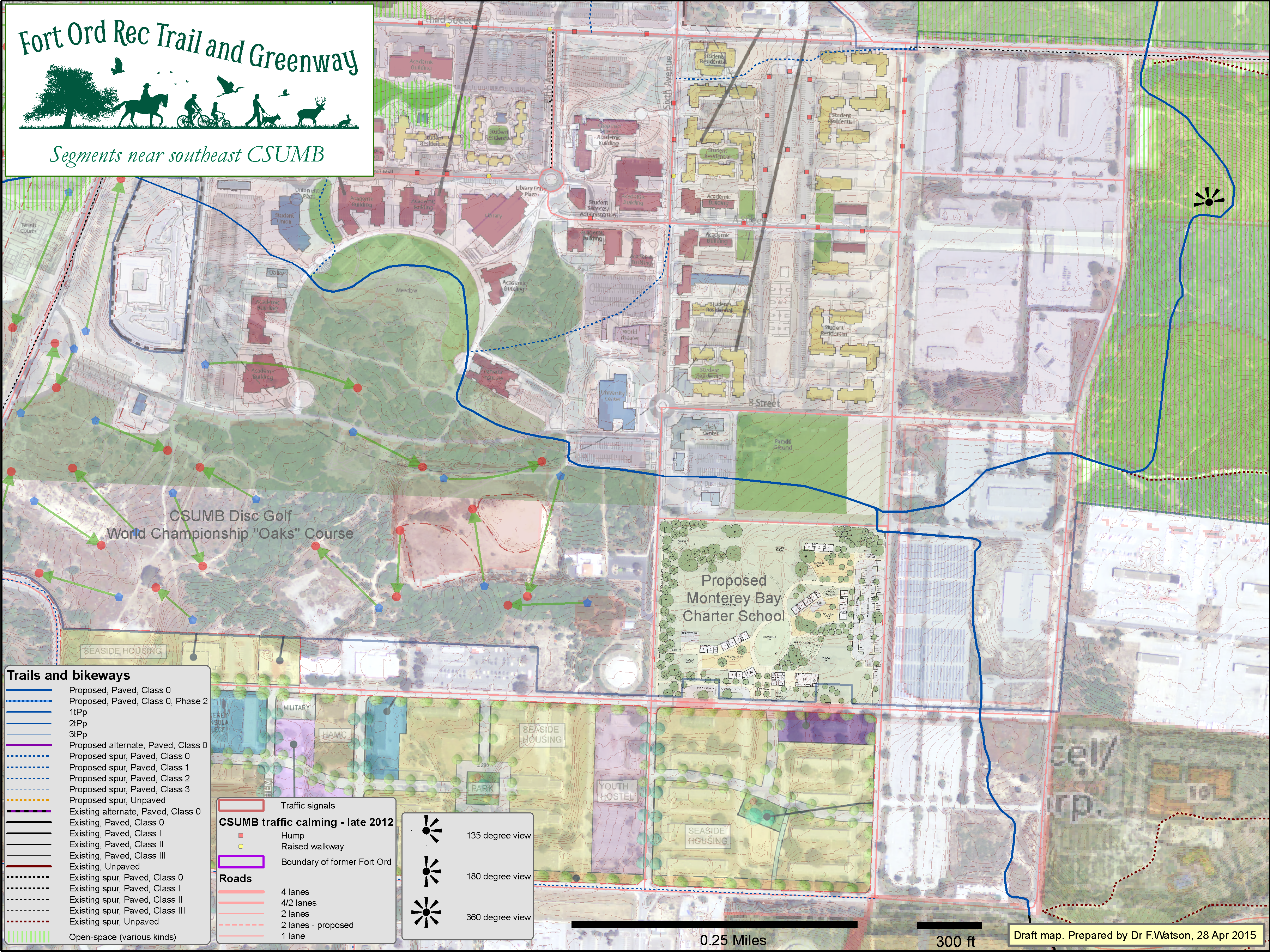
Click map to enlarge
CSUMB southwest - 26 Oct 2015

Click map to enlarge
CSUMB far west - 27 Oct 2015

Click map to enlarge
Canyon Del Rey area - 17 Nov 2016

Click map to enlarge
Laguna Grande - 11 Dec 2015

Click map to enlarge
Laguna Grande - western end - 16 Dec 2015
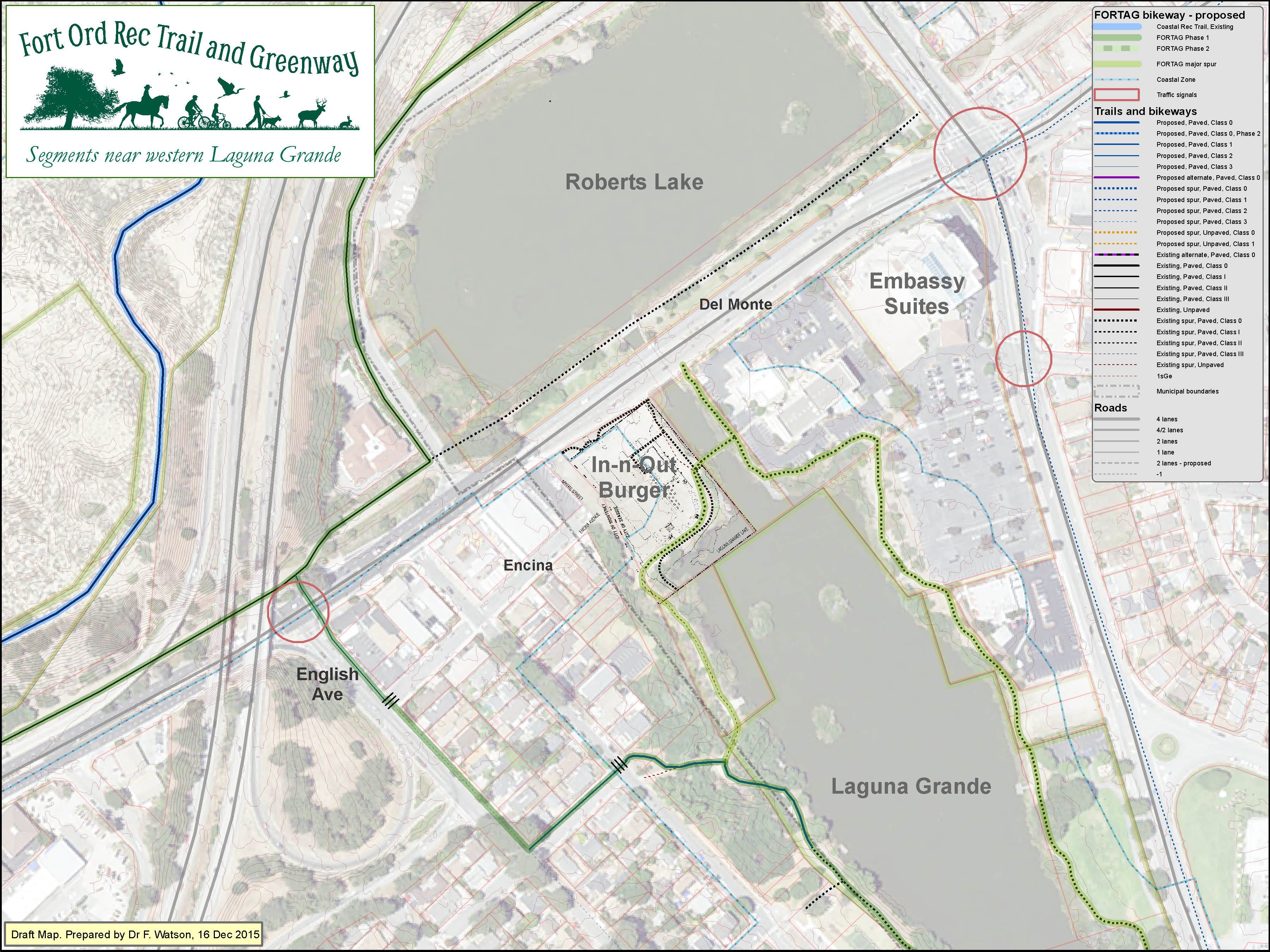
Click map to enlarge
Laguna Grande - eastern end - 17 Dec 2015

Click map to enlarge
Del Rey Oaks - West - 10 April 2015
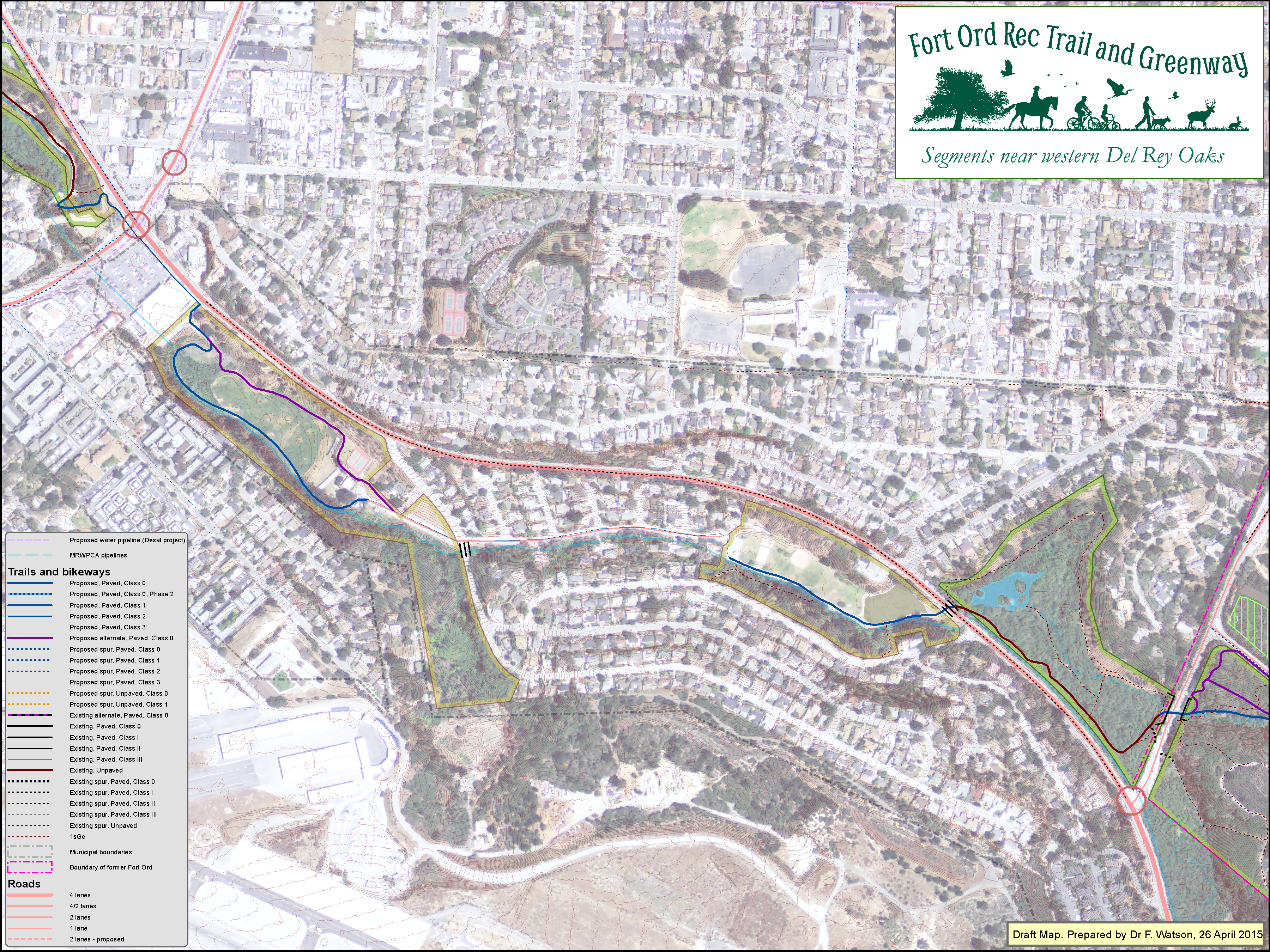
Click map to enlarge
Del Rey Oaks - East - 19 Sep 2016
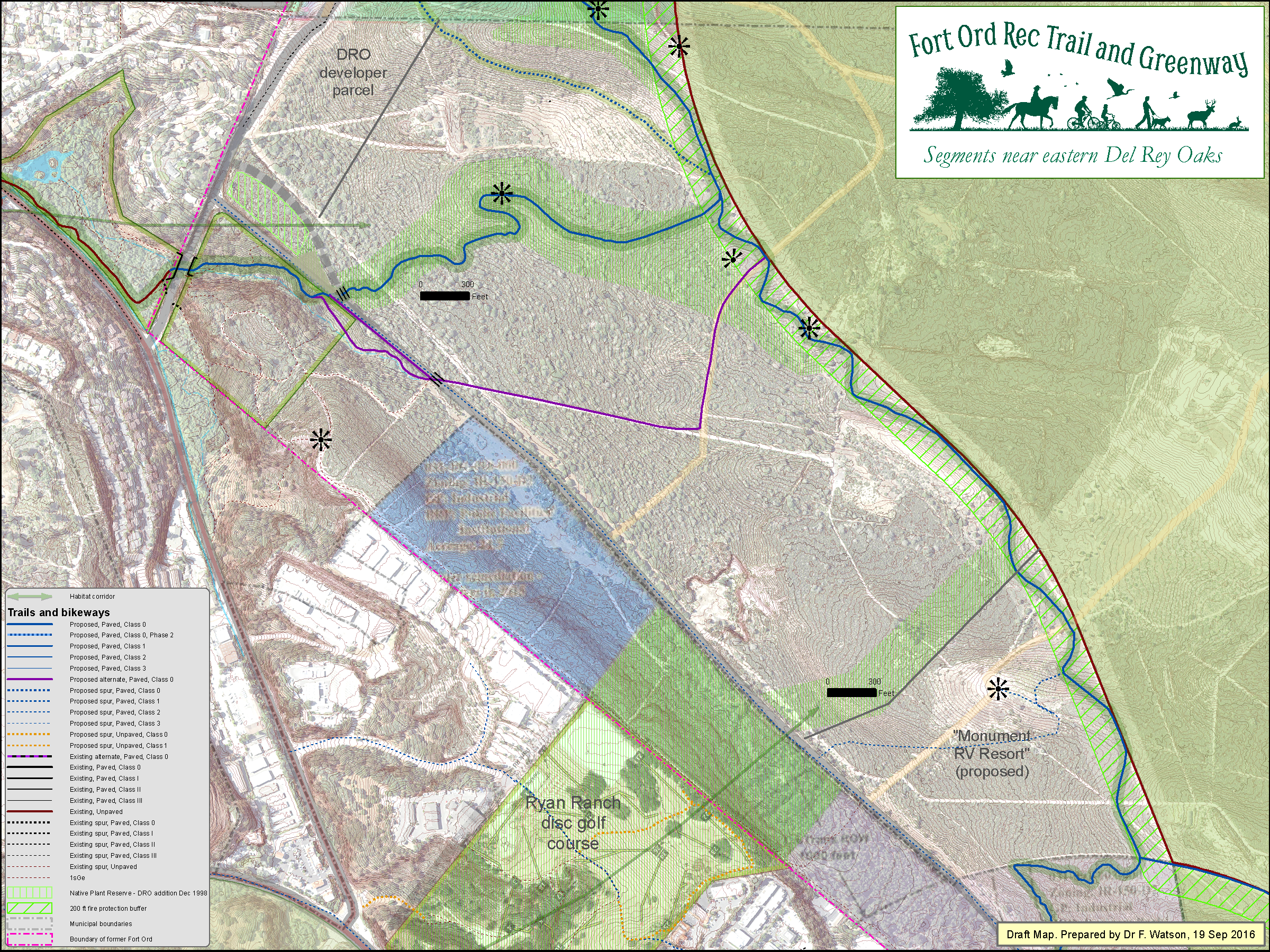
Click map to enlarge
Central Loop - simple layout - 1 April 2016
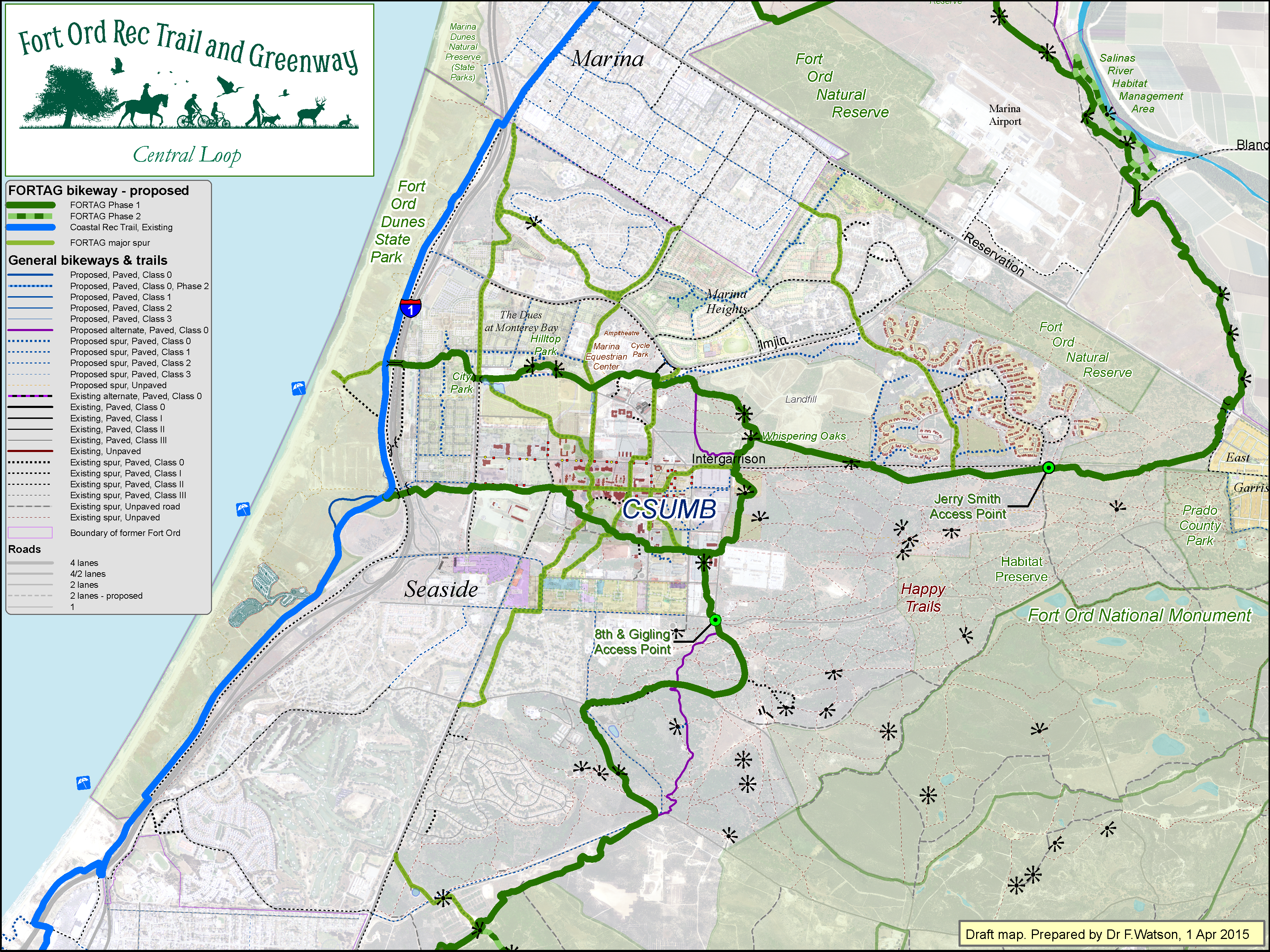
Click map to enlarge
Southern Loop - simple layout - 1 Oct 2016
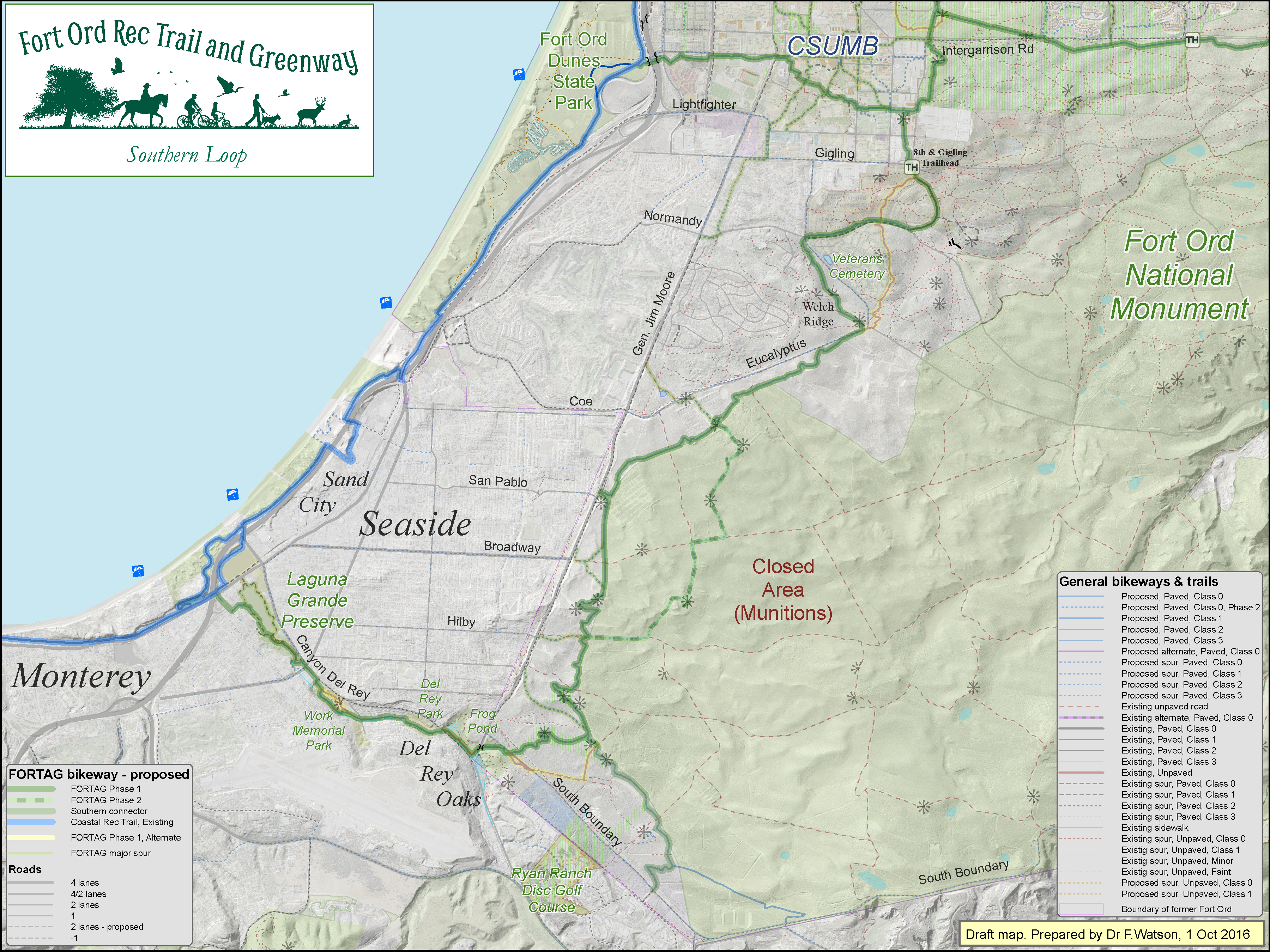
Click map to enlarge
Presidio Annex - 20 Oct 2015
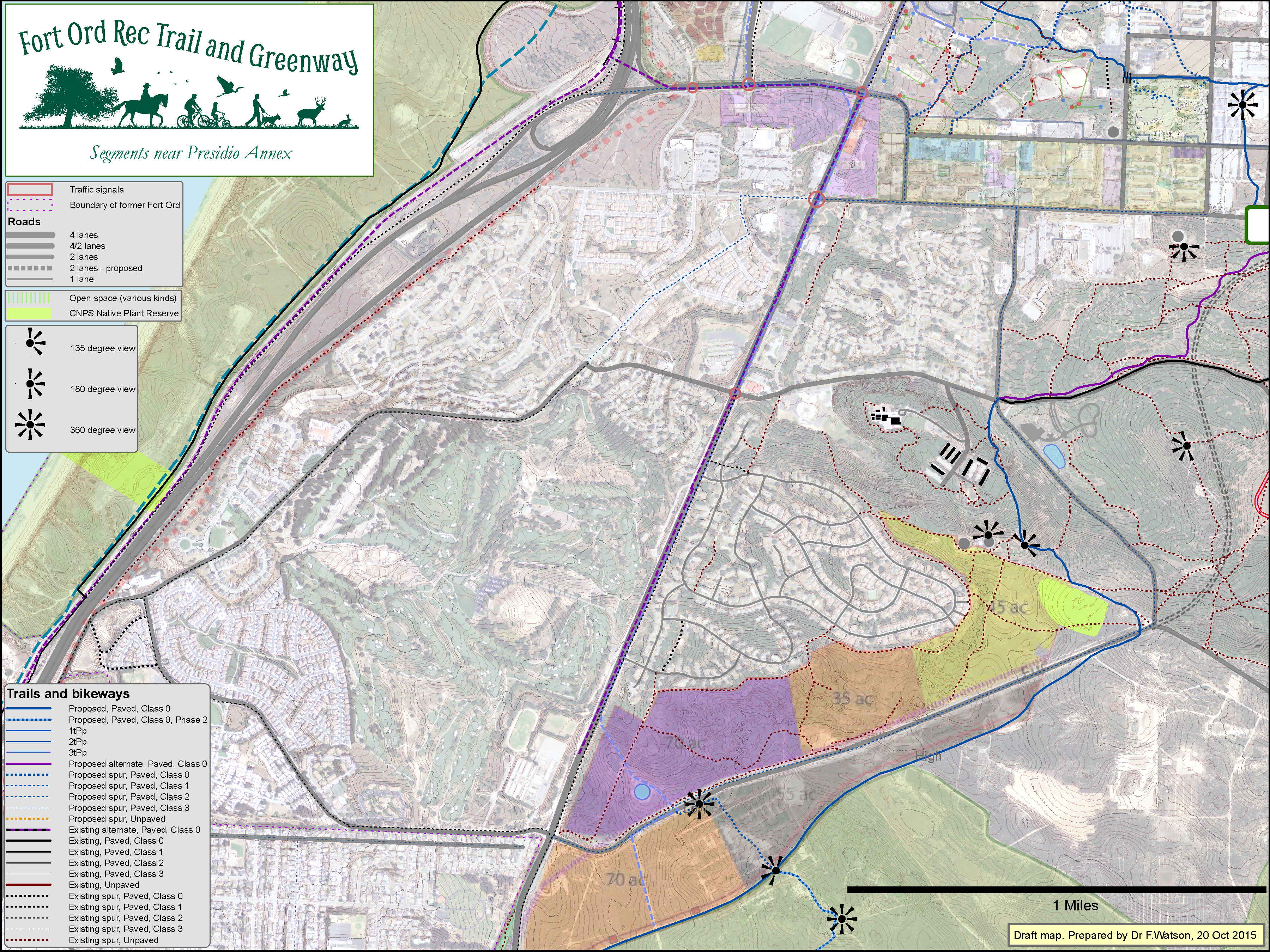
Click map to enlarge
MPC EVOC & firing range - 27 Oct 2016
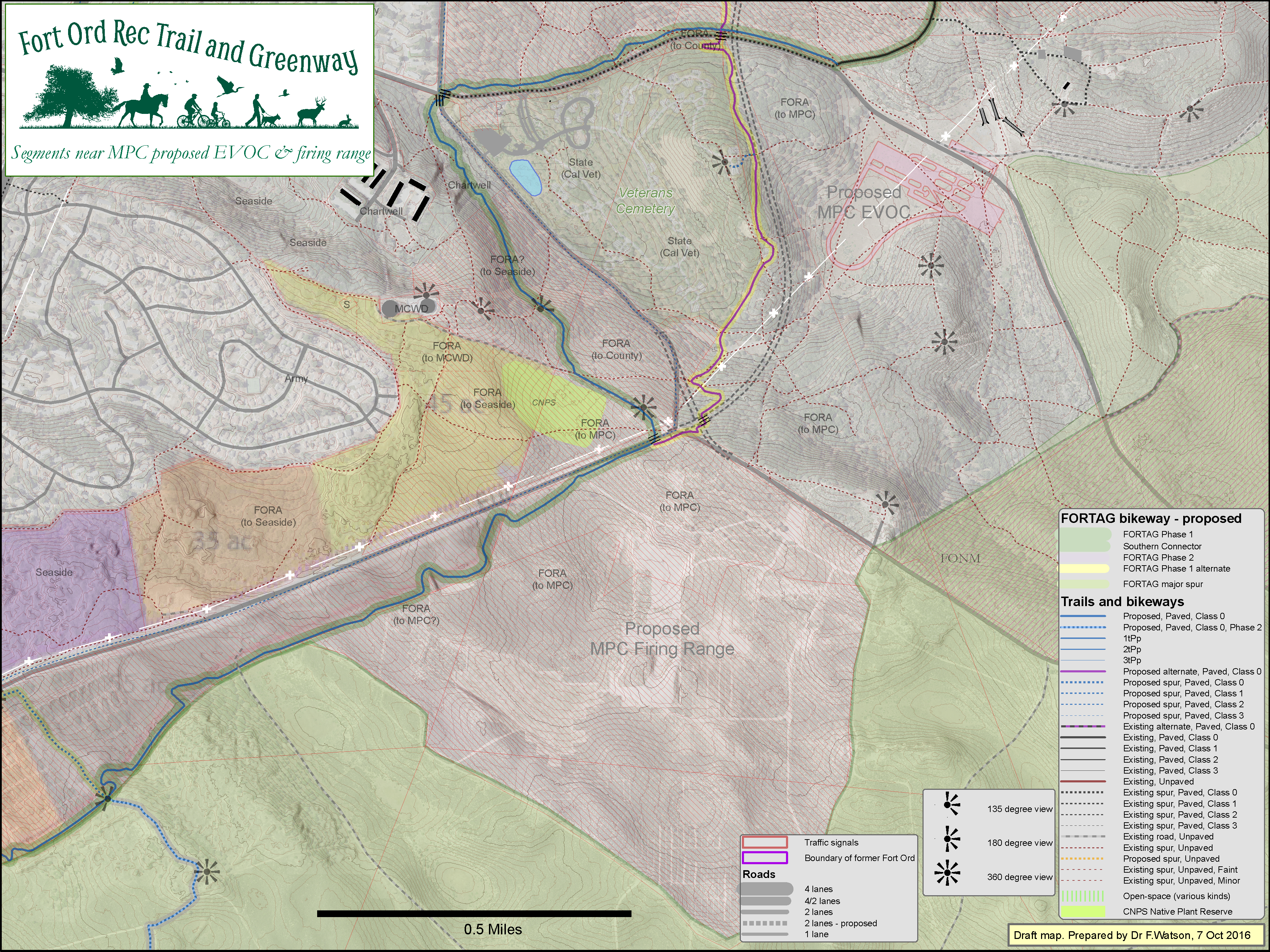
Click map to enlarge
Veterans Cemetery - 11 Sep 2015

Click map to enlarge
Fort Ord Reuse Plan - Hiker/Biker Trails - 13 Feb 2015
Click map to enlarge
Fort Ord Reuse Plan - Hiker/Biker Trails - Simpler Version - 20 April 2015
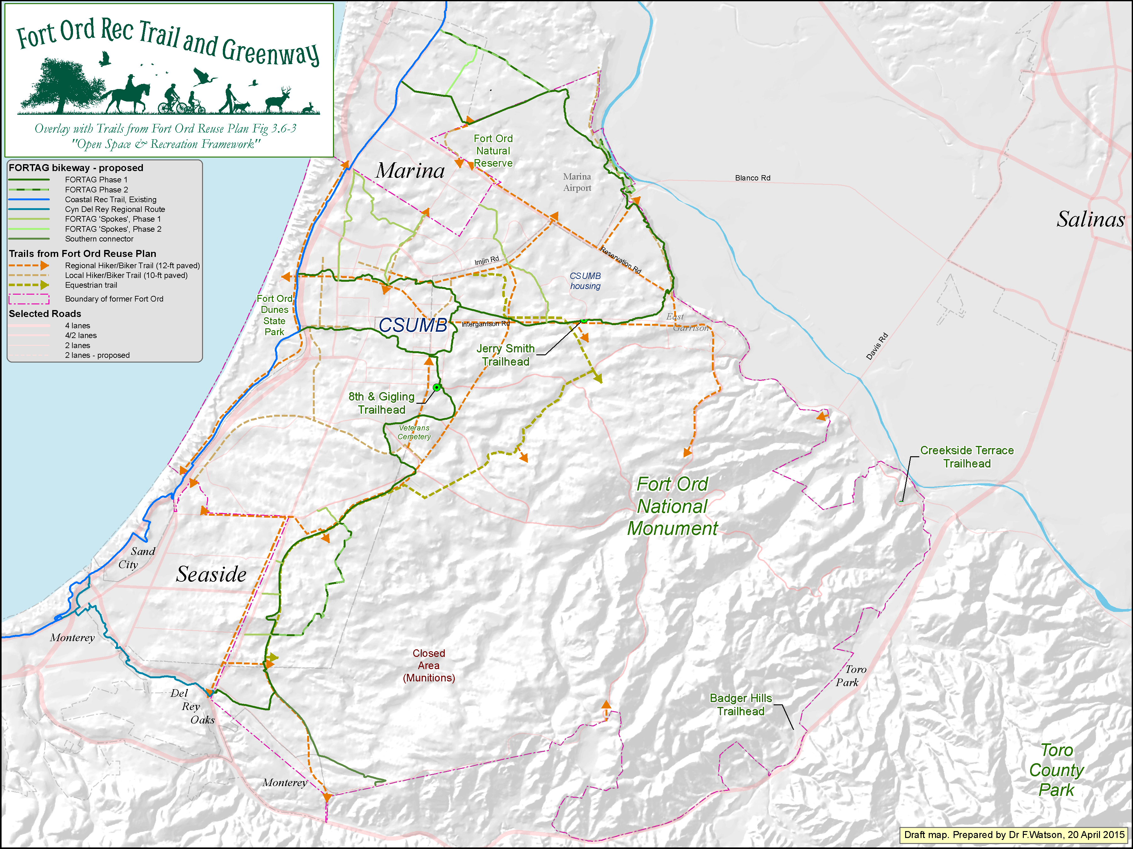
Click map to enlarge
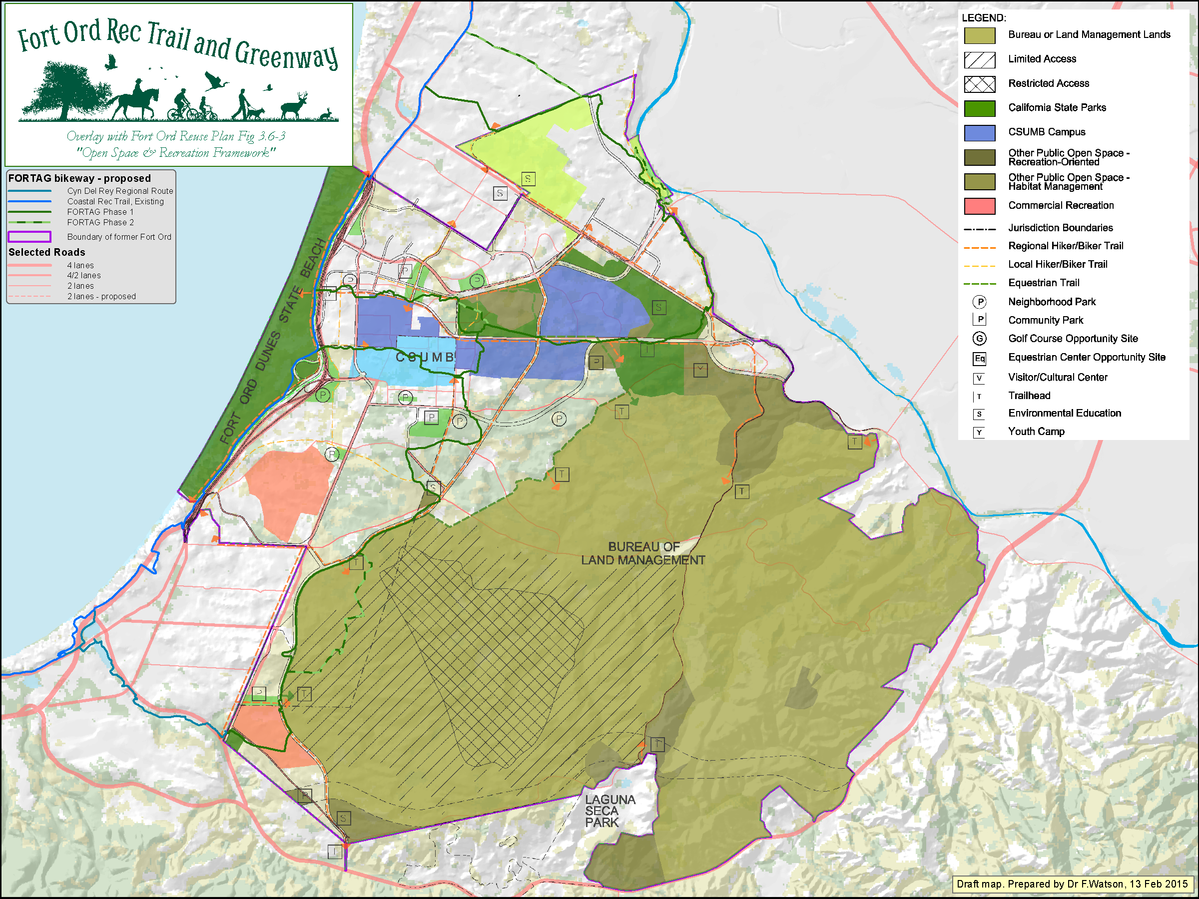
Fort Ord Reuse Plan - Land Use

Click map to enlarge
Lengths of trail segments - 24 May 2016

Click map to enlarge
Slopes of trail segments - portrait view - 10 May 2016
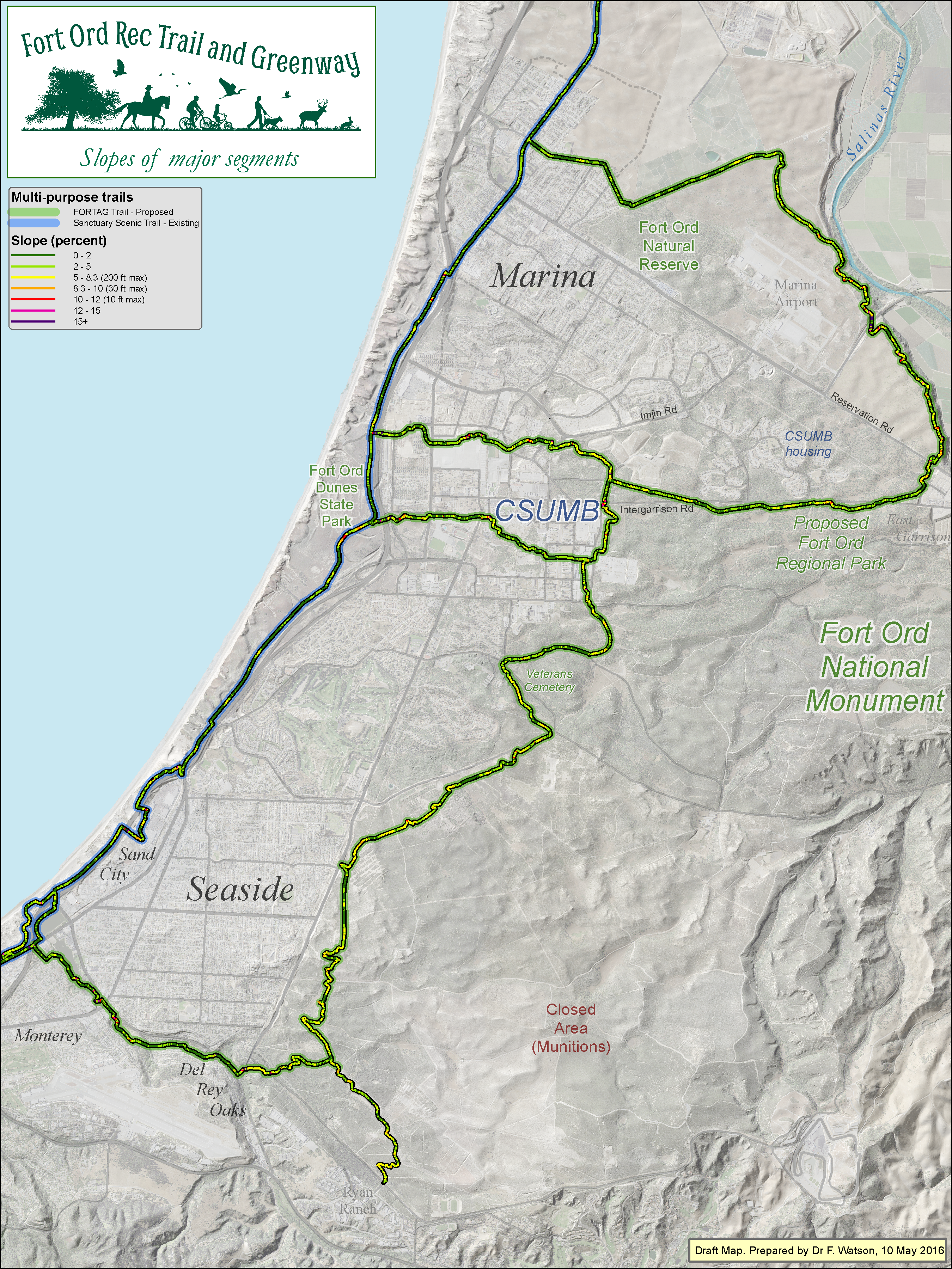
Click map to enlarge
Elevation of surrounding terrain - 6 Dec 2016
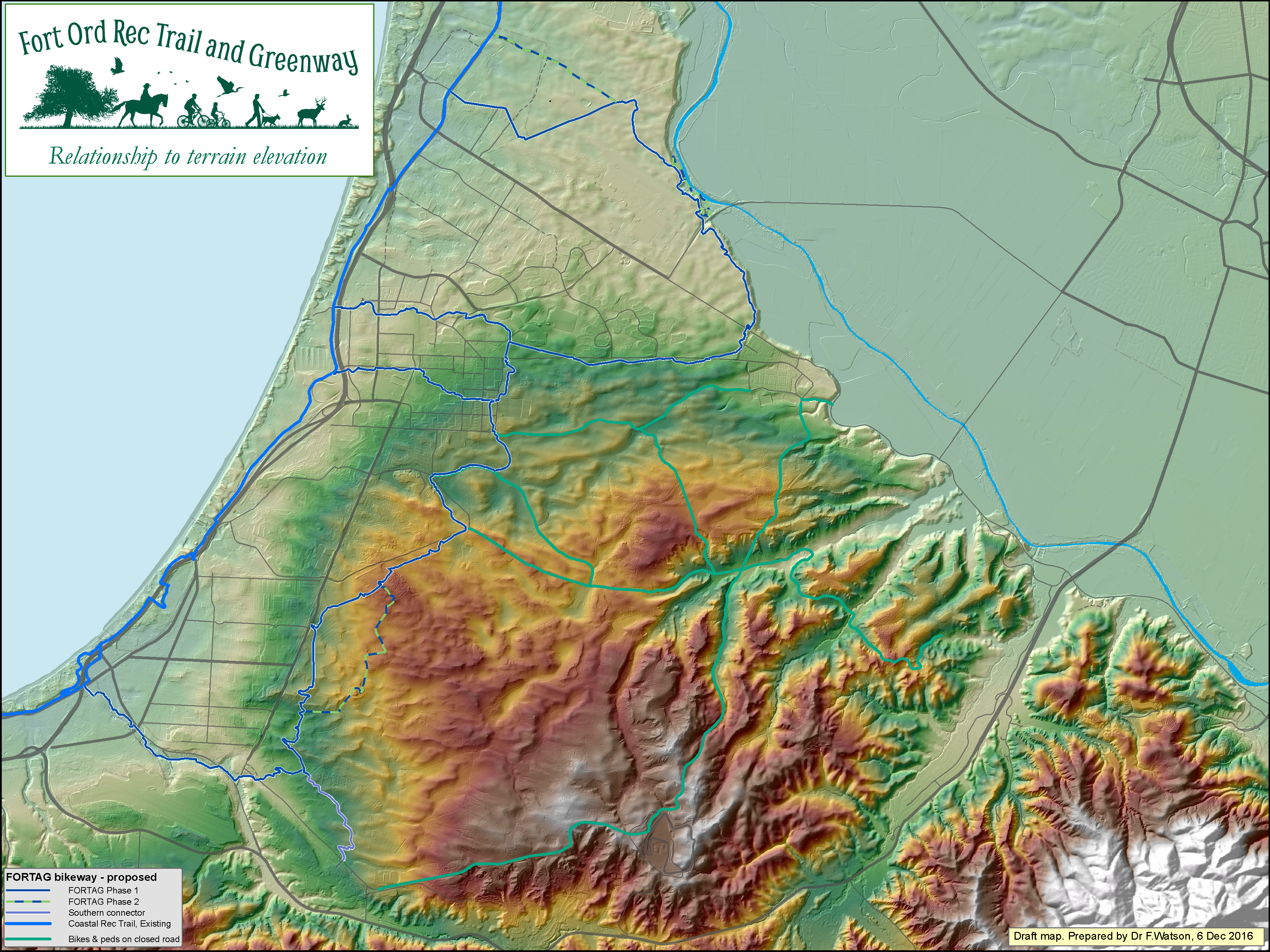
Click map to enlarge
Relationship to regional water infrastructure - 10 May 2015

Click map to enlarge
Notes on sites most relevant to planning in Seaside - 27 Oct 2016
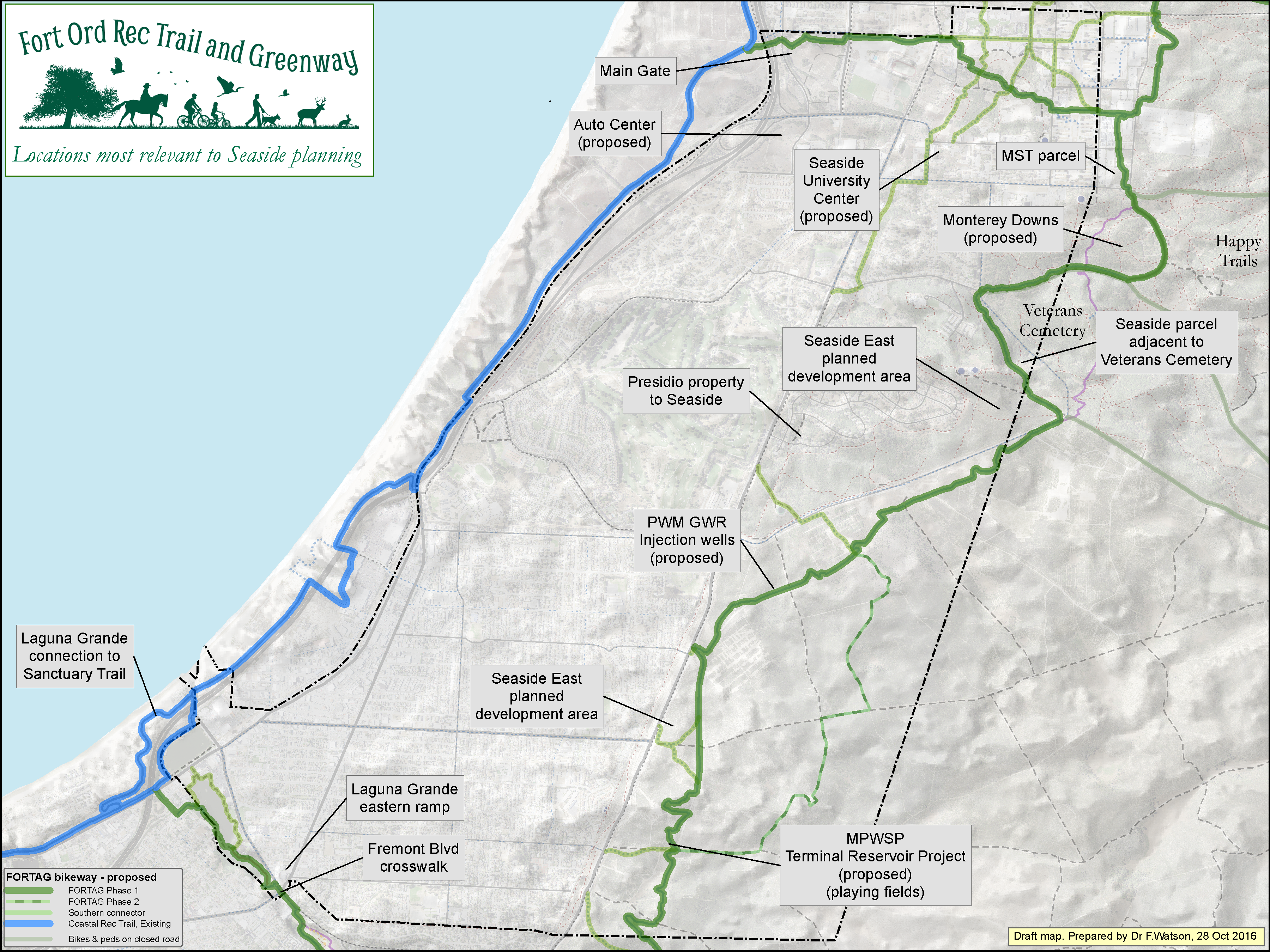
Click map to enlarge
FORTAG elements included in TAMC Transportation Safety & Improvement Plan
Click map to enlarge
Terrain cross-slope and anticipated retaining walls
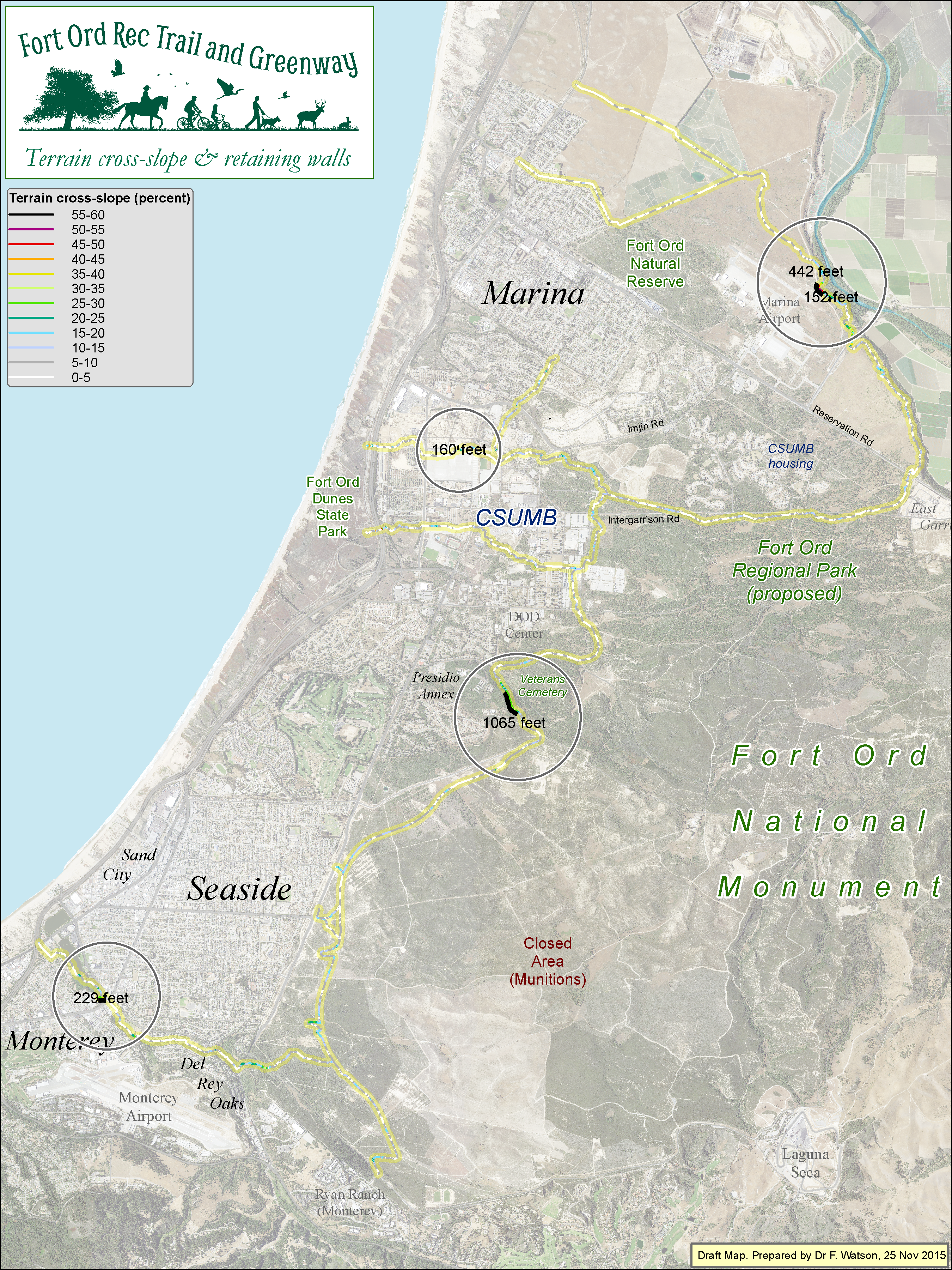
Click map to enlarge
Relationship to schools - 27 May 2016
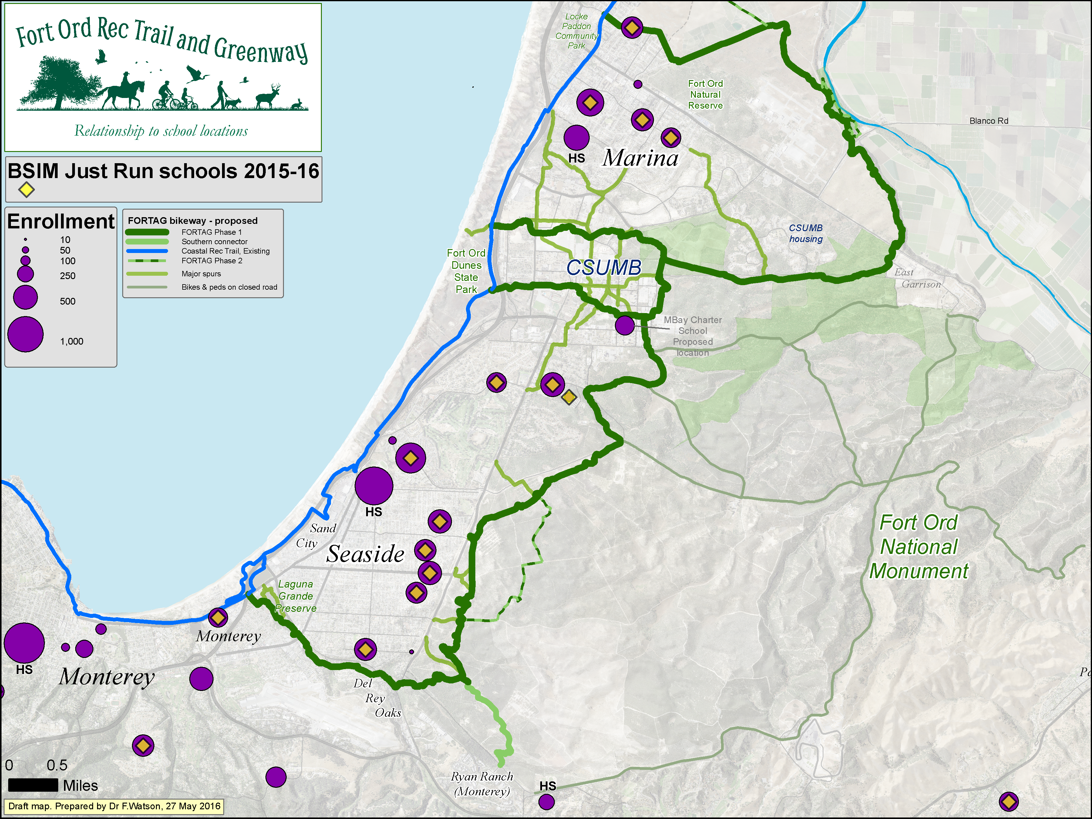
Click map to enlarge
Relationship to population - 13 May 2016
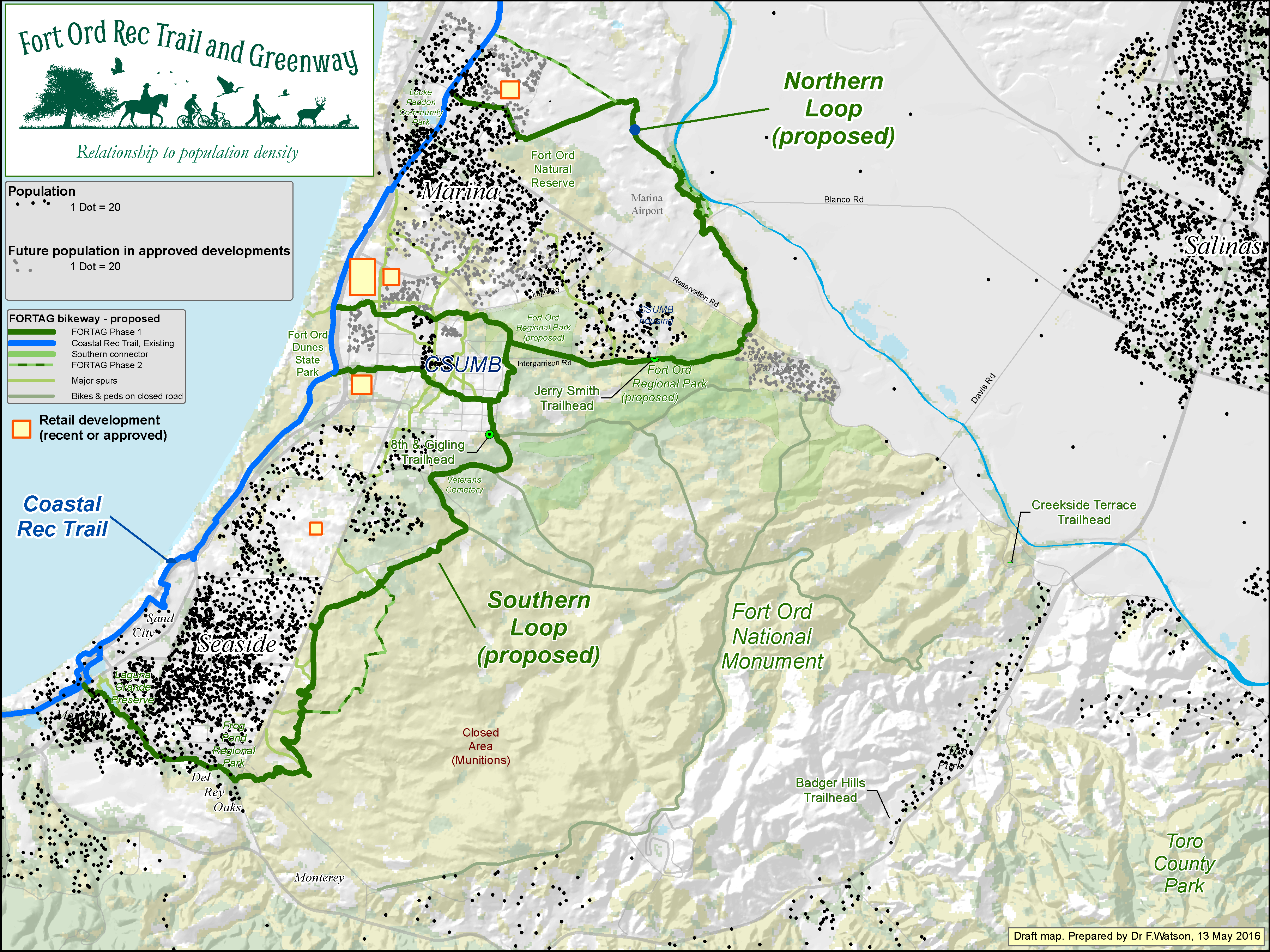
Click map to enlarge
Relationship to employment - 6 Dec 2016
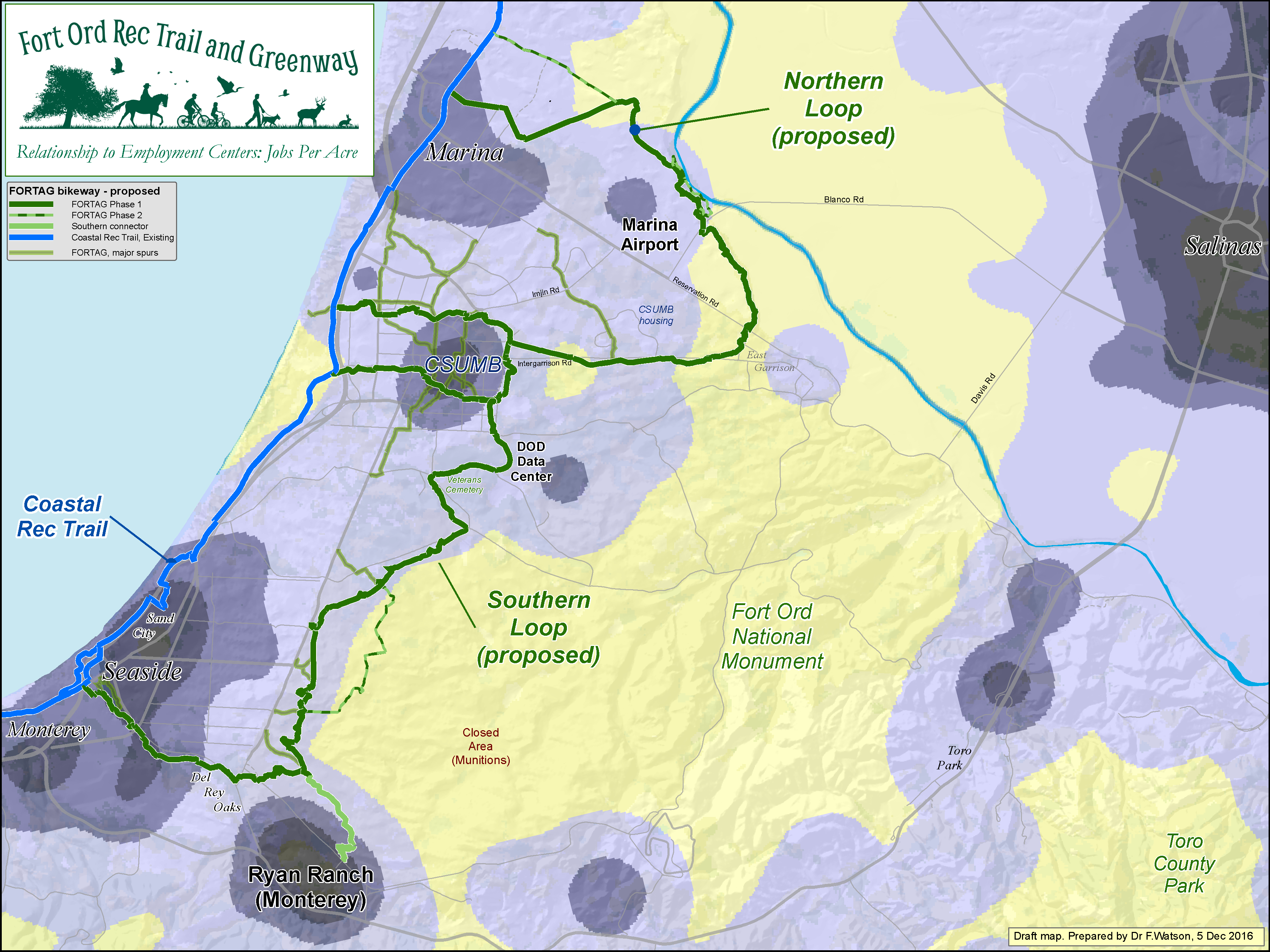
Click map to enlarge
Relationship to city revenue - 16 Dec 2015
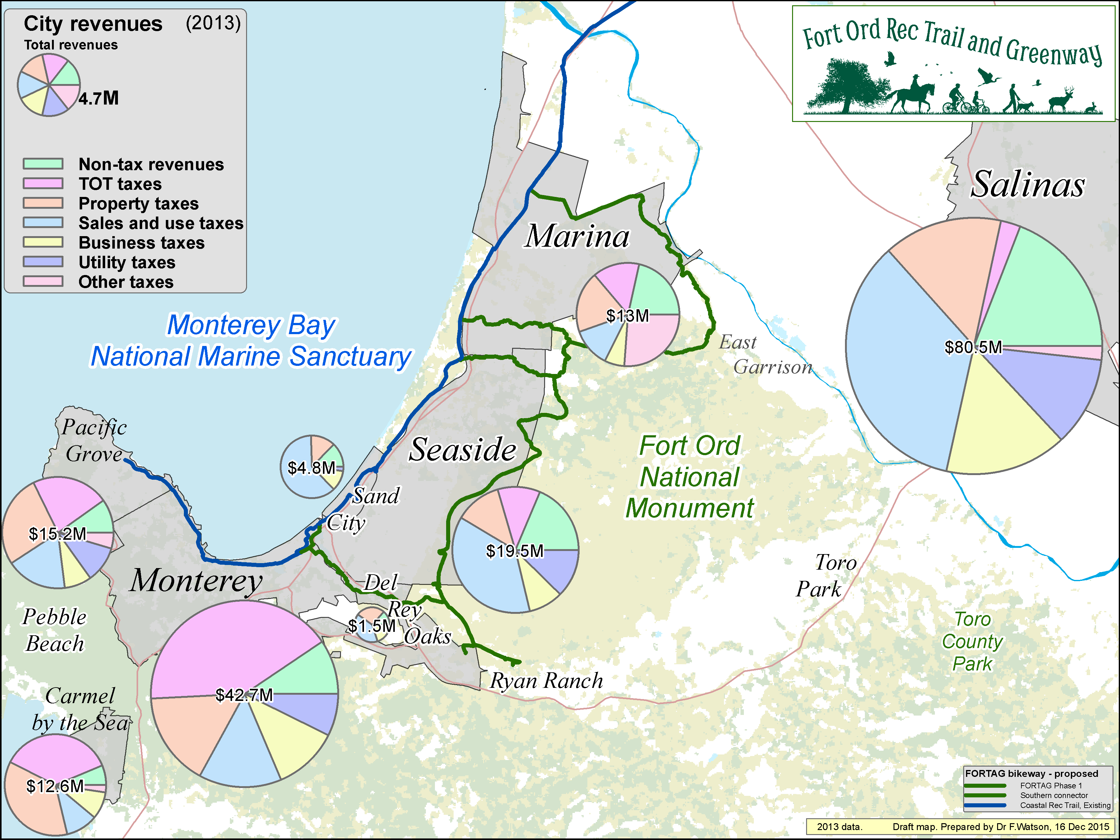
Click map to enlarge
Relationship to hotels - 29 May 2016
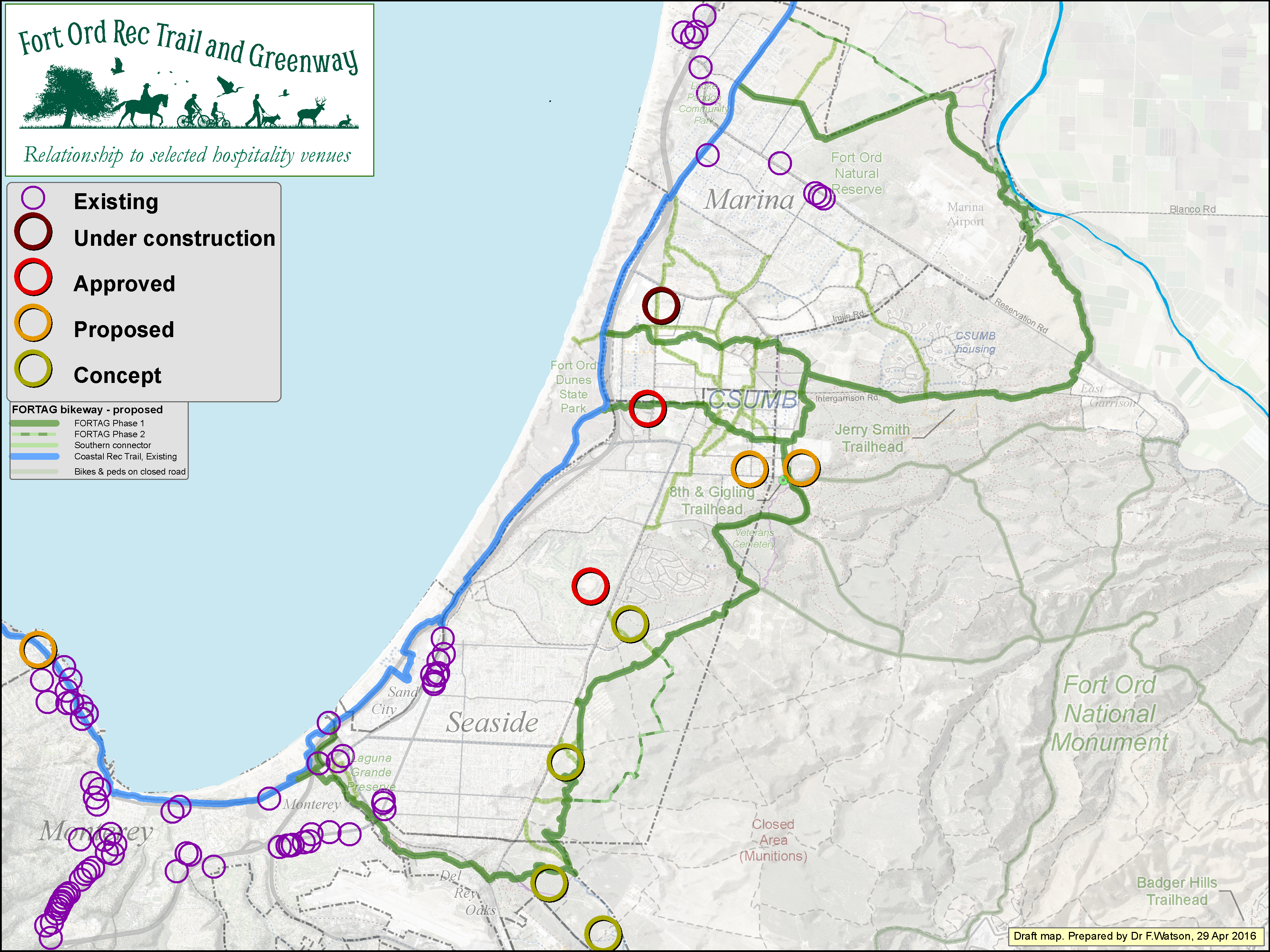
Click map to enlarge